
Tia 작성
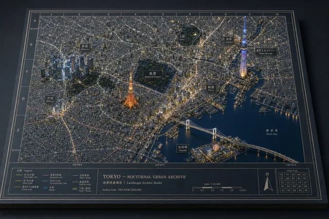
Tokyo Nocturnal Urban Archive
인포그래픽 / 교육 비주얼 · 제품 마케팅 · 3D 렌더 · 사진
10264
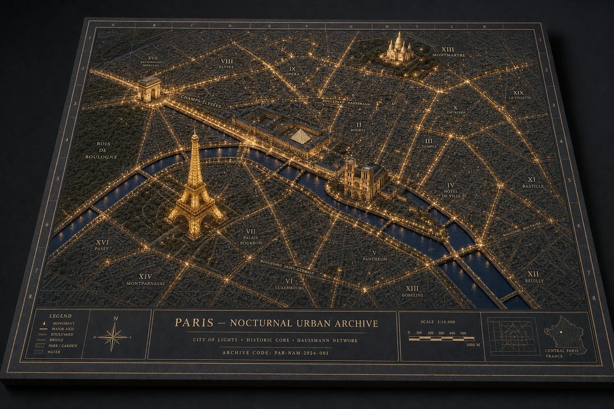
Generates a cinematic physical diorama-style night map of Paris with raised landmarks, glowing boulevards, archival labels, and museum cartography details.
복사하거나 수정할 수 있는 전체 프롬프트입니다.
Goal: Create a museum-quality physical diorama map titled PARIS — NOCTURNAL URBAN ARCHIVE, showing Paris at night as an archival landscape model with glowing streets, raised landmarks, annotation labels, and a refined cartographic border.

Canvas: Landscape 3:2 perspective view of a thick rectangular archive board resting on a dark matte tabletop. Camera is angled from above, slightly front-facing, so the board has visible thickness and cast shadows. Use a dark navy, charcoal, and antique-gold palette with restrained warm amber lighting.

Layout: The main map fills most of the board, surrounded by a double-line gold border and an alphanumeric coordinate grid. Use letters A–K across the top edge and numbers 1–8 down the side edges. At the bottom, include a structured information band split into 5 visible panels: 1) a legend panel, 2) a compass rose panel, 3) a large centered title/archive text panel, 4) a scale bar panel, and 5) a locator-map panel.

Subject details: Render the city as a dense low-relief 3D urban model with thousands of tiny matte buildings, engraved street blocks, and a dark blue river cutting horizontally through the lower-middle area. Major boulevards and bridges glow as fine amber light lines, creating a precise nighttime network. The water should be satin navy with subtle reflections. Parks should appear as darker textured green-black areas.

Raised landmarks: Include exactly 4 prominent illuminated miniature landmarks, each larger and more sculptural than the surrounding buildings: 1) the Eiffel Tower in the lower-left/left-center area near the river, glowing gold; 2) the Arc de Triomphe in the upper-left area with bright radial avenues; 3) Notre-Dame Cathedral on the island near the center-right river bend; 4) Sacré-Cœur on the upper-right hill area. Keep the landmarks physically plausible, matte, finely detailed, and warmly lit.

Map labels and annotations: Add fine serif gold typography directly on the map, like an architectural archive plate. Include exactly 14 visible district/area labels: XVII Batignolles Monceau, VIII Élysée, IX Opéra, XIII Montmartre, XIX La Villette, X Entrepôt, II Bourse, III Temple, IV Hôtel de Ville, XI Bastille, XII Reuilly, XIII Gobelins, VI Luxembourg, XIV Montparnasse. Add major route labels including Champs-Élysées, Boulevard Haussmann, Boulevard Saint-Germain, and Boulevard Bessières. Labels should be legible but small, integrated into the model.

Bottom information band text: In the center title panel, show the title PARIS — NOCTURNAL URBAN ARCHIVE. Under it, add the subtitle CITY OF LIGHTS · HISTORIC CORE · HAUSSMANN NETWORK. Add a final small line: ARCHIVE CODE: PAR-NAM-2024-001. In the legend panel, list exactly 5 items with small symbols: Monument, Major Axis, Boulevard, Bridge, Park / Garden, Water. In the scale panel, show “SCALE 1:10,000” with a segmented bar labeled 0, 100, 200, 300, 400, 500, and 1000 M. In the locator panel, include a small grid diagram and a tiny outline map labeled “CENTRAL PARIS FRANCE.”

Visual style: Hyper-realistic macro photography of a handcrafted architectural archive model; matte black paper, engraved gold ink, miniature plaster or resin buildings, warm pinprick LED-like city lights, shallow depth of field, crisp central details, soft vignette, realistic paper grain, tactile board edges, subtle dust and material texture. The image should feel like a physical museum diorama photographed in low light, not a flat digital map.

Constraints: Keep the palette dark and elegant; no people, cars, modern UI, bright neon, or glossy plastic. Preserve the single-board archival presentation and the exact 4 raised landmarks, 5 bottom panels, 5 legend items, and 14 district/area labels.
같은 모델과 카테고리의 관련 프롬프트입니다.
Tia 작성
인포그래픽 / 교육 비주얼 · 제품 마케팅 · 3D 렌더 · 사진
Tia 작성
인포그래픽 / 교육 비주얼 · 제품 마케팅 · 3D 렌더 · 사진
Tia 작성
인포그래픽 / 교육 비주얼 · 제품 마케팅 · 3D 렌더 · 사진
Soulful Ai 작성
게임 에셋 · 제품 마케팅 · 3D 렌더 · 사진
Gadgetify 작성
제품 마케팅 · 인포그래픽 / 교육 비주얼 · 사진 · 3D 렌더
Gadgetify 작성
인포그래픽 / 교육 비주얼 · 제품 마케팅 · 3D 렌더 · 사진